
view satellite weather pics
Page 1 of 1

view satellite weather pics
![]() by dean Wed Sep 04, 2013 2:42 pm
by dean Wed Sep 04, 2013 2:42 pm
[i


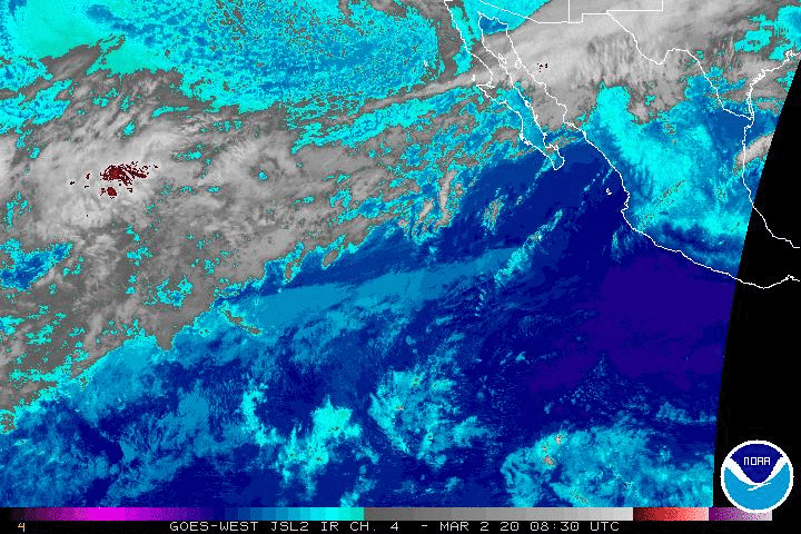
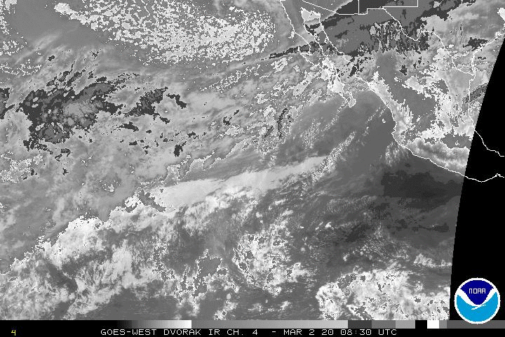
http://www.goes.noaa.gov/HURRLOOPS/hpir.html
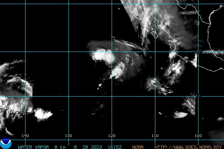
water vapor
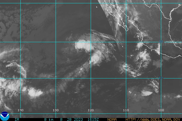
IR
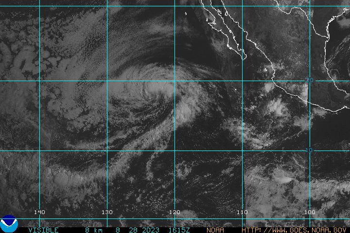
visable


http://preview.weather.gov/graphical/?zoom=3&lat=10.91198&lon=-68.37891&layers=00BFTFTTTTT®ion=7&element=9&mxmz=true&barbs=true

for written warnings
http://www.nhc.noaa.gov/text/MIATWDEP.shtml
http://www.nhc.noaa.gov/satellite.php
this is the best chart for water temp, I can not post because it is protected because of copyright so not able to show.
http://www.terrafin.com/sstview/showFreeChart.php?ct=free&zn=wcrv&rg=sobaja&ix=1


here are waves

http://magicseaweed.com/North-East-Pacific-Surf-Chart/24/?chartType=TMP#?chartType=TMP&_suid=137830751615607519982515368611
http://www.wunderground.com/wundermap/?lat=23.45000&lon=-110.21667&zoom=10&type=hybrid&units=metric&pin=Todos+Santos%2C+Mexico&plat=23.450001&plon=-110.216667&tl.play=0&tl.spd=2&viewportstart=now-3756&viewportend=now-156&groupSevere=1&groupHurricane=1&groupFire=1&groupCamsPhotos=1&groupRealEstate=1&eyedropper=0&extremes=0&fault=0&favs=0&femaflood=0&fire=0&firewfas=0&fissures=0&fronts=0&hurrevac=0&hur=0&labels=0&lightning=0&livesurge=0&mm=0&ndfd=0&rad=0&dir=1&dir.mode=driving&sst=0&sat=0&seismicrisk=0&svr=0&ski=0&snowfall=0&stormreports=0&tor=0&tfk=0&tsunami=0&riv=0&wxsn=0&cams=0&pix=0
for written warnings
http://www.nhc.noaa.gov/text/MIATWDEP.shtml
http://www.nhc.noaa.gov/satellite.php
http://www.goes.noaa.gov/HURRLOOPS/hpir.html
water vapor
IR
visable
http://preview.weather.gov/graphical/?zoom=3&lat=10.91198&lon=-68.37891&layers=00BFTFTTTTT®ion=7&element=9&mxmz=true&barbs=true
for written warnings
http://www.nhc.noaa.gov/text/MIATWDEP.shtml
http://www.nhc.noaa.gov/satellite.php
this is the best chart for water temp, I can not post because it is protected because of copyright so not able to show.
http://www.terrafin.com/sstview/showFreeChart.php?ct=free&zn=wcrv&rg=sobaja&ix=1
here are waves
http://magicseaweed.com/North-East-Pacific-Surf-Chart/24/?chartType=TMP#?chartType=TMP&_suid=137830751615607519982515368611
http://www.wunderground.com/wundermap/?lat=23.45000&lon=-110.21667&zoom=10&type=hybrid&units=metric&pin=Todos+Santos%2C+Mexico&plat=23.450001&plon=-110.216667&tl.play=0&tl.spd=2&viewportstart=now-3756&viewportend=now-156&groupSevere=1&groupHurricane=1&groupFire=1&groupCamsPhotos=1&groupRealEstate=1&eyedropper=0&extremes=0&fault=0&favs=0&femaflood=0&fire=0&firewfas=0&fissures=0&fronts=0&hurrevac=0&hur=0&labels=0&lightning=0&livesurge=0&mm=0&ndfd=0&rad=0&dir=1&dir.mode=driving&sst=0&sat=0&seismicrisk=0&svr=0&ski=0&snowfall=0&stormreports=0&tor=0&tfk=0&tsunami=0&riv=0&wxsn=0&cams=0&pix=0
for written warnings
http://www.nhc.noaa.gov/text/MIATWDEP.shtml
http://www.nhc.noaa.gov/satellite.php
dean- Posts : 5539
Join date : 2008-01-01
» accu weather and lapaz weather
» for today,,,
» a view
» to and from Cabo/L Ventana
» posting on the ventana view guidlines
» for today,,,
» a view
» to and from Cabo/L Ventana
» posting on the ventana view guidlines
Page 1 of 1
Permissions in this forum:
You cannot reply to topics in this forum